
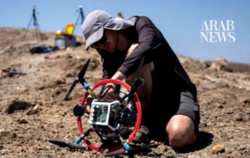
On the Aeolian island of Vulcano, off the coast of Sicily, researchers are testing drones to measure volcanic gases as a means to predict eruptions. German scientist Marius Schaab from the Technical University of Munich (TUM) operates a drone that reflects a laser beam to collect data on gas emissions at the crater's edge. The drone positions itself along the axis of a ground-based sensor that emits an invisible laser through volcanic gas plumes. The sensor works by sending a laser beam through the gas to a reflector on the drone, measuring the intensity of the light. "Our drone flies behind the plume and also our ground unit is not in the plume," Schaab explained, highlighting that the corrosive nature of volcanic gases would require constant recalibration of sensors placed inside the plume.
Gas Measurement Technology
The system uses a laser to avoid the gas plume, allowing the drone to switch angles for comprehensive measurements. Based on the signals returned to the sensor, an algorithm calculates a map of gas concentration within 10 to 15 minutes as the drone follows a predefined path up to 60 meters (nearly 200 feet). Although drones have been used in volcano monitoring for about 15 years, scientists are now developing more accurate and risk-free gas measurement tools. Another team from the University of Mainz is using drones equipped with sensors to measure chemical substances in the air near the crater.
Anticipating Eruptions
"One reason for measuring gases and particles is to better understand the impact of volcanic eruptions and volcanic emissions on the atmosphere," said Tjarda Roberts, a researcher at the National Center for Scientific Research (CNRS) in Paris collaborating with the Mainz team. "Another reason is to anticipate volcanic eruptions, because the gas composition can change before an eruption occurs," she added. The greater the pressure from rising lava, the larger the amount of gas released. It is the first time the TUM team has tested its drone system, which can work at altitudes up to 3,000 meters, on a volcano.

Drone Flexibility and Safety
A student from Johannes Gutenberg University Mainz, Jonas Krajewski, prepares the drone named "Tina" for flight. Weighing 2.5 kilograms (5.5 pounds), the drone follows a predefined path for up to 40 minutes, flying into fumaroles where temperatures range between 100 and 140°C. "Tina" is equipped with sensors measuring gases, particles, and halogens like chlorine and bromine. "We have a very constant output of gas... so we can have very reliable sensor data," said Krajewski. Roberts emphasized the drone's flexibility to move through diluted parts of the plume and quickly change direction if the plume shifts, eliminating the need for researchers to enter dangerous gas areas. "Here we don't have a major risk of an imminent eruption but there are volcanoes where you can't reach the summit on foot," Roberts noted. With a drone, "you can take measurements... without putting yourself in danger."
Next Challenge: Mount Etna
In the coming days, the drone will face a new challenge at Mount Etna, the 3,000-meter-high active volcano in eastern Sicily, where a new eruption has just occurred. The last eruption of Vulcano's Grand Crater was in the late 19th century, but the volcano continues to show intense degassing activity, attracting visitors who walk around the rim.